cosermap logo
Local Weather
7-Day Forecast
Show Local Weather
Loading...

ultraman tiga rainbow bridge

Ultraman Tiga

Tokyo

Episode
Ep. -
Time
-
ultraman tiga rainbow bridge
  • Nearest Station: Shibaura-futo Station (Yurikamome Line)
  • Walk: 15 minutes on foot
  • Best time to visit: Late afternoon to night for bridge lighting, or clear daytime for matching the bridge structure
  • Crowd level: Moderate
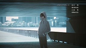
  • Ultraman Tiga towers beside Tokyo’s Rainbow Bridge in a dramatic urban battle shot.
  • This moment appears at a peak point in the battle, with Ultraman Tiga emerging around Tokyo Bay and protecting the city with his overwhelming scale and presence. Rainbow Bridge is not just a landmark in the frame, but also a visual symbol that strengthens the tension of a modern metropolis in crisis. Tiga carries the mission of saving humanity, and the mood combines determination, calm resolve, and a touch of tragic grandeur, giving the scene an epic and pressurized feeling before or after a decisive clash. The real-life model is clearly Rainbow Bridge near Odaiba in Tokyo, and the suspension structure, wide waterfront view, and surrounding bay-city scenery match the anime composition very closely. The anime simplifies nearby buildings and roadside details to emphasize the scale of the giant-hero battle, so in real life you will notice more lamps, guardrails, traffic signage, and port facilities than in the scene. The illuminated bridge is especially recognizable at night, while daytime is better for matching the bridge towers and shoreline geography; for anime pilgrimage purposes, the overall landscape is highly identifiable, though finding the exact angle can be harder because of shoreline redevelopment, viewpoint limits, and safety restrictions.
Can I walk onto Rainbow Bridge to recreate the Ultraman Tiga view?
Yes, the Rainbow Bridge promenade is usually open seasonally during daytime hours, but access can be restricted in bad weather or strong wind. Check the latest official Rainbow Bridge walkway information before you go.
Where is the best photo spot for comparing the anime scene with real life?
The Odaiba waterfront and areas near Shibaura-futo give the clearest bridge profiles for comparison, while Google Street View helps narrow down the angle in advance. Exact matching can be tricky because some shoreline viewpoints have changed over time.
Are tripods or long photo sessions allowed around the bridge area?
On public waterfront paths, casual photography is generally fine, but avoid blocking walkways and follow local posted rules. Some observation and promenade areas discourage large equipment during busy periods, especially at night.


© 2026 Coser Map. All rights reserved.