cosermap logo
Local Weather
7-Day Forecast
Show Local Weather
Loading...

the disappearance of haruhi suzumiya shukugawa tandai bus stopshukugawa gakuin junior collegearch bridge

The Disappearance of Haruhi Suzumiya

Kyoto

Episode
Ep. -
Time
57m 10s
the disappearance of haruhi suzumiya shukugawa tandai bus stopshukugawa gakuin junior collegearch bridge
  • Nearest Station: Shukugawa Station (Hankyu Kobe Line) or the Shukugawa Tandai-mae bus stop on local Nishinomiya routes
  • Walk: About 12 minutes on foot from Hankyu Shukugawa Station, or right by the bus stop
  • Best time to visit: Late afternoon in winter or on a clear overcast day for a subdued atmosphere close to the film
  • Crowd level: Usually quiet
  • A quiet street-side view frames the arch bridge near Shukugawa Tandai bus stop, emphasizing the film’s subdued winter atmosphere.
  • This moment appears during a section of the story when the atmosphere grows increasingly strange and subdued. As Kyon moves through a city that feels both familiar and subtly alien, the ordinary roads, bridge, and neighborhood scenery create a mood of daily life mixed with detachment. Rather than focusing on action, the frame reflects his unease and introspection: everything in front of him looks normal, yet it does not quite match the world he remembers. This kind of brief street view supports the emotional shift before and after the incident, as he slowly realizes that reality has changed and struggles to confirm what is real. In real life, the spot is near the “Shukugawa Tandai-mae” bus stop, looking toward the arch bridge over the river, and the overall composition is very close to the anime. The road alignment, the curve of the bridge, the guardrails, and the layered residential streetscape match especially well. The anime simplifies some background elements for visual consistency, so utility lines, roadside details, and vegetation may appear cleaner than on site, while the bus stop sign, traffic signs, and nearby building facades may have changed slightly over time. Even so, the bridge itself and the change in street elevation remain the clearest identifiers, and comparing the frame with the actual location or Google Street View makes the accuracy of the geography and camera angle easy to appreciate.
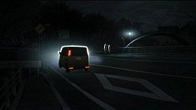
Is the bridge view from the anime still easy to recognize today?
Yes. The arch bridge, road slope, and residential layout are still the main visual markers, although minor signage and streetside details have changed over time.
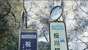
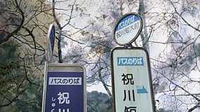
Can I recreate the shot safely from the bus stop area?
Yes, but stay clear of the roadway and avoid blocking the bus stop sign or waiting passengers. The best angle is from the sidewalk near the stop rather than stepping into traffic.
Is there a best way to compare the scene before visiting?
Yes—use Google Street View around the Shukugawa Tandai-mae bus stop and the nearby bridge approach first. It helps you match the camera height and confirm which side of the street gives the closest composition.

© 2026 Coser Map. All rights reserved.