cosermap logo
Local Weather
7-Day Forecast
Show Local Weather
Loading...

suzume shin arakawa ohashi bridge

Suzume

Tokyo

Episode
Ep. -
Time
83m 2s
suzume shin arakawa ohashi bridge
  • Nearest Station: Kita-Senju Station (JR Joban Line, Tokyo Metro Chiyoda Line/Hibiya Line, Tobu Skytree Line, Tsukuba Express)
  • Walk: 20–25 minutes on foot
  • Best time to visit: Late afternoon on a clear day for wide river views similar to the film
  • Crowd level: Moderate
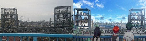
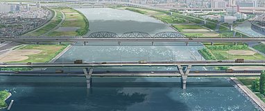
  • Suzume and Souta move through a riverside bridge setting, framed by the broad urban landscape around Shin-Arakawa Ohashi Bridge.
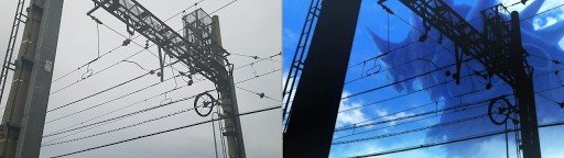
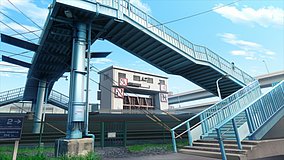
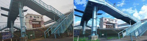
  • This moment in Suzume comes during the pair’s journey through a Tokyo-edge urban landscape, where Suzume and Souta pass through the riverside bridge area with a mood that blends urgency, fatigue, and a quiet pause for reflection. As they continue their dangerous mission, the wide river view and open space amplify their anxiety, determination, and growing trust in each other, giving emotional weight to the scenes that follow. In real life, Shin-Arakawa Ohashi Bridge on the Arakawa riverbank is a large metropolitan bridge landmark, and the anime recreates the river channel, bridge structure, skyline, and embankment layout with strong recognizability. While the film simplifies some signage, traffic elements, and surrounding visual noise to focus more on mood and character, the bridge silhouette, road alignment, and expansive riverside view remain easy to match on location. Visitors will notice that the real site has heavier traffic, more detailed railings, road textures, and urban fixtures, and some angles may differ slightly due to fences, construction, or seasonal vegetation, but the overall landscape is very close to the anime and works especially well for comparison with maps and Street View.
Can I safely recreate the Suzume bridge shot at Shin-Arakawa Ohashi Bridge?
Yes, but use the pedestrian-accessible riverside and sidewalk areas rather than stopping near traffic lanes. The bridge carries heavy vehicle traffic, so prioritize safe angles from the embankment paths.
Is Google Street View useful for matching this Suzume location before visiting?
Yes, Street View and map comparison are very helpful here because the bridge shape, embankment, and river alignment are easy to recognize. Some exact anime angles may still need on-foot adjustment due to barriers and road geometry.
Are there facilities or rest spots near Shin-Arakawa Ohashi Bridge for anime pilgrims?
Yes, the broader Kita-Senju area has convenience stores, cafes, and station facilities before you walk to the river. The riverside itself is more functional than tourist-oriented, so bring drinks if you plan to stay for photos.

© 2026 Coser Map. All rights reserved.