cosermap logo
Local Weather
7-Day Forecast
Show Local Weather
Loading...

naruto soyokazeden naruto to mashin to mitsu no onegai dattebayo naruto calendar december

NARUTO: Soyokazeden - Naruto to Mashin to Mitsu no Onegai Dattebayo!!

Kyoto

Episode
Ep. -
Time
-
No image available
  • Nearest Station: Tsu Station (JR Kisei Main Line / Kintetsu Nagoya Line / Ise Railway)
  • Walk: Around 20–30 minutes on foot, depending on the exact viewing point
  • Best time to visit: Late afternoon in winter for a similar seasonal atmosphere and softer light
  • Crowd level: Usually quiet
  • A seasonal promotional frame presents a warm, festive year-end mood associated with Naruto rather than a specific narrative action scene.
  • This moment comes from promotional or calendar-style artwork rather than a standard story scene, so the emphasis is on atmosphere and seasonality instead of a clearly defined plot event. The image conveys the lively yet warm feeling of the end of the year, suggesting a brief pause where the characters can step away from danger and simply exist in a cheerful, relaxed mood. Within the broader experience of the NARUTO series, visuals like this feel like breathing spaces outside the main storyline, strengthening the sense of closeness between the characters and deepening the emotional bond between the franchise and its fans across the seasons. Based on the provided coordinates, the real-world point is in the Tsu area of Mie Prefecture, Japan, and it seems better understood as a pilgrimage reference point or compositional inspiration rather than a frame-perfect real-life match. Calendar illustrations of this kind are often heavily stylized, with simplified backgrounds and artistic adjustments, so the actual site will not necessarily reproduce every detail exactly. Building features, road width, vegetation, and nearby signage are likely to differ, and any shop signs, street markers, or public fixtures may also have changed over time since around 2007. For fans, the location works best as a place to compare atmosphere, landscape outlines, and changes in the streetscape, especially when combined with maps and Street View to study road alignment, building massing, and viewing angles and to see how much the anime reworked the real setting.
Is this an officially recognized Naruto pilgrimage spot in Tsu?
There does not appear to be official tourism signage or a permanent Naruto marker at this coordinate. Most fans visit it as a reference point tied to the 2007 calendar visual rather than as a formal anime tourism site.
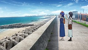
Can I recreate the exact calendar shot here?
Probably not frame-for-frame, because the image is a stylized calendar illustration rather than a strict background reproduction. Street View and an on-site angle check are the best way to compare the road layout and surrounding forms.
Are there any photography restrictions or facilities nearby?
As this appears to be a normal public area, casual photography from public space is generally fine, but avoid blocking traffic or photographing private property too closely. Tsu Station and nearby commercial streets offer restrooms, food, and convenience stores for pilgrimage planning.

© 2026 Coser Map. All rights reserved.