cosermap logo
Local Weather
7-Day Forecast
Show Local Weather
Loading...

naruto soyokazeden naruto to mashin to mitsu no onegai dattebayo naru to mitsuno onegai

NARUTO: Soyokazeden - Naruto to Mashin to Mitsu no Onegai Dattebayo!!

Kyoto

Episode
Ep. -
Time
-
No image available
  • Nearest Station: Kintetsu Nara Station (Kintetsu Nara Line)
  • Walk: About 15–20 minutes on foot
  • Best time to visit: Late morning or golden hour on a clear day for easier angle matching and cleaner photos
  • Crowd level: Moderate
  • A calm transitional frame captures the light, whimsical adventure mood of this Naruto side story while emphasizing the setting over direct action.
  • This moment comes from the lighter, more whimsical side of NARUTO: Soyokazeden - Naruto to Mashin to Mitsu no Onegai Dattebayo!!, where the tone feels closer to a playful side adventure than the main story. At this point, the characters are usually in a transition between events, so the mood is less tense and more filled with curiosity about what comes next, relaxed interactions with companions, and a sense of anticipation before the next action begins. If the frame focuses more on the setting than on the characters, it further emphasizes that brief pause in the story, letting viewers settle into an everyday atmosphere as gentle as a breeze before the next joke, commotion, or wish comes true. Compared with the real-world location, this spot feels more like a commemorative site linked to promotional or calendar artwork than a perfectly traceable anime cut. Based on the coordinates 34.6846, 135.8401 in the Nara urban area, the actual setting is defined by ordinary roads and city streets, with the slopes, street scale, and mixed residential-commercial Kansai atmosphere standing out clearly. If the anime background was simplified or stylized, visitors will notice differences in building details, signage placement, utility poles, road markings, and the density of greenery. Anime artwork often removes the clutter of real-world signs to create a cleaner composition, so matching the scene on site is easier through the road layout, building silhouettes, and distant terrain rather than exact sign-by-sign comparison. Overall, the accuracy here is closer to a match in atmosphere and geographic feeling than a frame-perfect recreation, so it works best when paired with maps and Street View for angle checking before taking comparison photos.
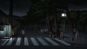
Is this an officially marked Naruto pilgrimage spot in Nara?
There is no widely recognized official on-site Naruto marker here; fans usually treat it as an inferred match tied to promotional or calendar material rather than a formal tourism collaboration spot.
Can I recreate the scene accurately with Google Street View before visiting?
Yes, Street View is the best way to pre-check road alignment and surrounding buildings here, because exact signage and small background details differ from the stylized anime artwork.
Are there any photography restrictions around this location?
General street photography is usually fine if you stay on public walkways, but avoid blocking traffic, filming private homes too closely, or using tripods in narrow pedestrian areas.

© 2026 Coser Map. All rights reserved.