cosermap logo
Local Weather
7-Day Forecast
Show Local Weather
Loading...
Episode
Ep. 1
Time
1m 25s
inada tamagawa park
  • Nearest Station: Keio Inadazutsumi Station (Keio Sagamihara Line) or Inadazutsumi Station (JR Nambu Line)
  • Walk: 15–20 minutes on foot
  • Best time to visit: Late afternoon on a clear day, especially in spring or early autumn
  • Crowd level: Usually quiet
  • Mashiro Kurata stands alone by the riverside, framed against the open sky and grassy riverbank in a calm reflective moment.
  • This moment appears in one of the quieter parts of the story, with Mashiro standing alone by the riverbank and gazing out at the calm, open scenery in a subdued and thoughtful mood. For her, it is not just a brief pause but a moment to sort out her feelings about the band, her friends, and the anxiety in her heart. Like the rest of Morfonication, the scene uses a peaceful setting away from the noise of daily life to highlight Mashiro’s emotional uncertainty and her effort to face herself honestly. In real life, the scene matches the Tama River bank around Inada-Tamagawa Park very closely, especially in the embankment path, grassy slope, and wide riverside view. The anime presents the riverbank with cleaner lines and brighter, softer colors to heighten the lyrical mood, while the real location changes with the seasons and may include signs, railings, sports facilities, or passing visitors. Although there is no special anime signage on site, the park’s riverside landscape is distinctive enough that fans can easily recognize it, and with a slight adjustment in angle, the real view can be recreated very accurately.
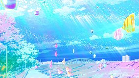
Is this exact Morfonication riverside spot easy to access on foot?
Yes. The Tama River embankment by Inada-Tamagawa Park is publicly accessible, and you can reach the riverside paths from nearby stations with a moderate walk.
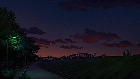
Are there any restrictions on taking anime pilgrimage photos at Inada-Tamagawa Park?
Casual photography is generally fine in the open park area, but avoid blocking paths, entering sports-use spaces, or photographing other visitors without permission.
What should I use to match the anime angle most closely?
Check Google Street View and satellite maps first, then visit in clear weather and adjust your position along the embankment slope to account for seasonal grass and fencing differences.

© 2026 Coser Map. All rights reserved.